Getting Started Hiking

Leave No Trace
We should really start with a little information on Leave no Trace. The clue is in the name really and whilst many people do this without even thinking there’s no harm in reflecting on the 7 LNT principles and building them into your adventures. Even if you think you’re doing a good job, that banana skin you’ve just thrown into the bushes may well take a number of years to biodegrade, just take it home (do remember to then remove it from your bag, which we often forget to do with unsatisfactory results…).
Plan Ahead and Prepare
Travel and Camp on Durable Surfaces
Dispose of Waste Properly
Leave What You Find
Minimise Campfire Impacts
Respect Wildlife
Be Considerate of Others
Safety and Communication
We have a few key tips picked up over the years that will really increase your safety on the mountains. This can seem like a dull topic but feeling safe provides you with more confidence which in turn means you will be more able to enjoy your trip :)
Note: we are not experts so please just take this as some friendly advice from our experience.
1. Let a trusted person know your plans
This one is mentioned a lot and is something we were guilty of not doing for a long time. However it's very quick and easy to just message someone with your route and estimated timings and it would be hugely helpful if something did go wrong whilst you were out.
2. Take a first aid kit
Of course there's no need to take an industrial first aid kit on a day hike but we would recommend taking a little time to think about / research what you are doing and common injuries and illness in that environment. It's relatively cheap and easy to put together a little first aid kit which again could prove massively beneficial in the event you need it (or even someone else).
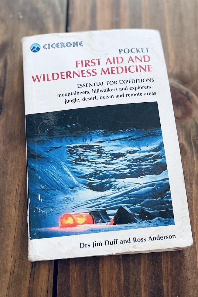
The Pocket First Aid and Wilderness Medicine book pictured is a great expedition accompaniment to advise on various ailments.
3. Utilise phone apps
There are an ever-growing list of super useful apps that help with safety in the outdoors. Here is a list of the ones we have downloaded:
OS locate - A great UK app that works anywhere in world. If you do get lost you can tell people exactly which longitude and latitude you’re at. It also has a nice built in compass as well.
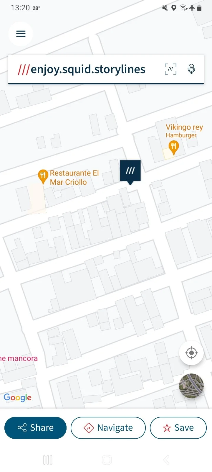
What3words - This app has divided the world into 3m squares and assigned each one a unique combination of three words. This makes your exact location easy to share.
BAA (Be Avalanche Aware) - A Scottish avalanche awareness service providing clear and thorough information.


4. Know how to contact mountain rescue UK
First of all, we'd highly recommend pre-registering by texting 'register’ to 999 then following the instructions. One key benefit to this is that you can text Mountain Rescue, which could really help if you have hearing or speech difficulties or even just poor phone signal.
In the event you need mountain rescue call 999 —> ask for the police —> ask for mountain rescue.
The mountain rescue website has a lot more useful information
5. Consider a satellite phone
The sat phone we have is the Garmin InReach Mini 2 so the info below is based on that. It's worth noting that there are loads more out there with even more advanced capabilities depending on what you need!
We didn't buy ours until we were about to hike the Pacific Crest Trail and be hiking for almost 6 months continuously. However, even if you're not going to be out for this long we'd say it's worth considering purchasing a sat phone for the following reasons:

• Emergency use: You won't need to rely on phone signal and battery in the case of an emergency. The sat phone has an SOS button and capability to send messages via satellite. It also has a great battery life.
• Check-in messages: These are pre-defined messages (such as 'I'm checking in, everything is ok') that you can very quickly send to family or friends to keep them updated on your location and status. With your monthly subscription you can send as many check-in messages as you want.
• Two way messaging: You can use this function to exchange messages with family and friends. We also found it useful to arrange things such as taxis from the trailhead or accommodation if you're out of phone signal.
The sat phone also has tracking capabilities but we've never used these (so as not to use up the battery) therefore can't comment at the moment unfortunately.
Details for the Garmin InReach Mini 2
Water Purification
One of our biggest takeaways from hiking is an appreciation for the simple things such as clean water. A lot of the water sources out in the wild may well be cleaner than tap water in your house but you never know for sure so it's always worth spending a little time purifying it to avoid cutting your trip short through water-borne illness.
Below are the main methods we've used but which one you choose is really down to the environment you're in and of course personal preference too.
1. Manual filters
The first one we tried was the MSR Trailshot with accompanying dirty/clean water bags. This system was great... until it broke after a relatively short time and the pump no longer functioned.
We were then lucky enough to be given a Sawyer water filter which are commonly used on the PCT. This worked great and we would certainly consider this system again. As it was second hand and we weren’t entirely sure how long we should use it for, hence moving onto a different filter after a while.
Currently we are using a Katadyn BeFree 1.0L filter/bag combo. We've had more long-term success with this system and would certainly recommend it, with the main positives being light weight, speed of filtration and ease of cleaning.
Top Tip: In sub-zero temperatures water filters can actually freeze and break. If you think it might freeze keep it in the tent or your bag where it’s less likely to freeze.
2. Water purification tablets
Not many people seem to use these apart from us but we personally find them super convenient, especially if you are purifying a larger quantity of water and don't want to sit squeezing it through a manual filter for hours!
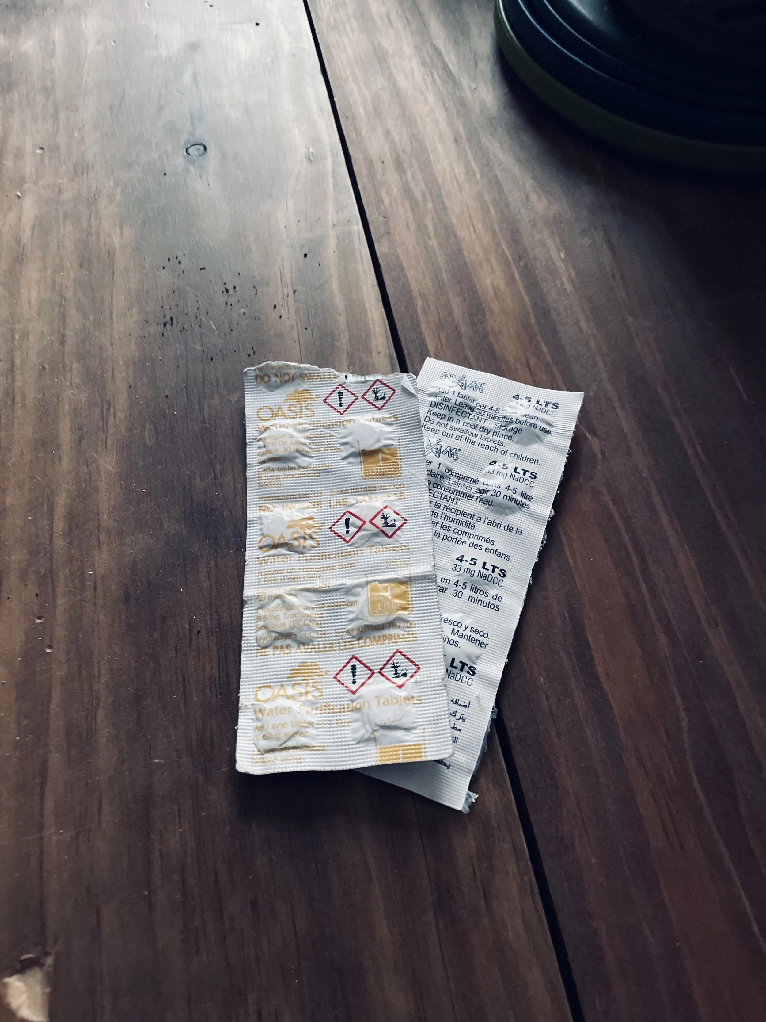
For years we've used the Oasis water purification tablets bought in bulk from Amazon for a reasonable price (much more cost effective than buying them from highstreet outdoor gear shops). We find them quick to dissolve and although they do alter the taste of the water slightly we personally don't find it offensive.
If your water source is likely to have a lot of material in it, you might still want to consider a manual filter.
3. Good old boiling
Don't forget that boiling water is also one method of purifying it. If you did this all the time then your camping gas wouldn't last long but on certain occasions it can be useful.
There are a million different opinions about the required boiling time but you will at least need to ensure the water comes to a rolling boil.
4. Water receptacles
For storage of smaller volumes of water (500ml - 1L) then we've found Nalgene bottles to be perfect. The 500ml size slots easily into the side of most backpacks, they have a useful little handle and most importantly you can cover them in stickers ;)
One of the other benefits of a Nalgene bottle is that you can fill it with boiling water. If you're particularly cold whilst camping then it can be used as a hot water bottle to keep your feet nice and toasty.
For storing larger volumes such as 2-3L we have used water bladder bags for many years, namely the brands Salomon and HydraPak. Through all this usage we've never had issues with leaking. One of the big advantages for me is being able to attach a hose for very easy-to-access hydration, especially when you're hiking uphill and don't want to stop every 5mins to get your bottle out. From experience, this is also helpful if swarms of mosquitos are also preventing you from stopping (eugh).

Core Gear
There are websites dedicated to reviews of all of the equipment listed below so what we’ll aim to do is just give a few pointers or tips that we’ve picked up. Regardless of how experienced you are, choosing the correct equipment can always be a bit of a minefield and the costs have the potential to add up, so think about the following:
If you’re not sure how often you’ll use the gear, it might to be worth hiring equipment to begin with. A quick google search should help.
Another great option is to look at online groups selling second hand equipment. If you’re based in the UK check out a Facebook group called Outdoor Gear Exchange UK (at the time of writing 140k people are members). No doubt there are similar groups wherever you are in the world.
Think practically. For example, what time of year will you be hiking? If you’re only going to head out on a few days/ nights in the summer when you know it will be warm and sunny, you might not need the high end four seasons sleeping bag…
If you get out a lot or know that you will be then review warranty and discounts certain brands offer. You might pay a lot for a Patagonia jacket or Osprey bag, but they both have a good warranty and service to repair/ replace (those are just two examples, there are plenty more!) Which should give your purchase a longer life.
Again, if UK based consider joining the MTA or BMC (see later in the article). Not only is this just a good thing to do any way if you’re often in the mountains/ outdoors, but they both offer some great discounts on gear.
A few specifics on products we’ve used:
Tents
We chose an MSR Access 2 for our PCT thru-hike. It’s at the more expensive end as we needed a tent that was good quality and lightweight. In reality we had a love/ hate relationship as the poles often broke. MSR did send us replacements but over time we lost confidence in the tent.
Backpacks
We both had Osprey bags for the PCT (Gav had the grey Aether Pro 70L and Claire had the pink Aura 65L). These were definitely on the larger size of bags for a thru-hike but they were comfortable (the Aura even more than the Aether) and months later having travelled across South America both are in great condition. So they’re certainly designed to last. If we choose another brand in the future it would be out of curiosity rather than necessity.


Sleeping bags
We both had the North Face Blue Kazoo sleeping bag which are rated down to an extreme of -10oC. When the temperature dropped below freezing overnight (as evidenced by the frozen tent and water bottles!) we both had to sleep with extra layers and eventually bought sleeping bag liners which worked a treat. Overall the sleeping bags have done pretty well though. We certainly won’t be in a rush to replace even after sleeping in them for 5 months straight!
Hiking boots: leather vs. light weight (semi gore-tex)
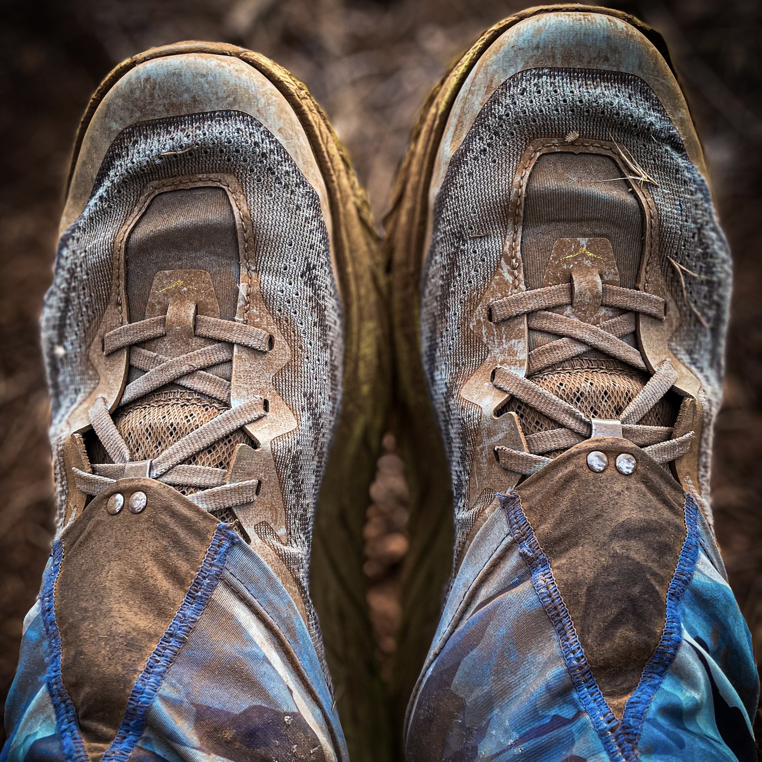
When we moved to the Lake District and started hiking more often we both bought classic brown leather hiking boots which served us fairly well. We probably didn’t look after them quite as well as we should which resulted in wear and tear that could have been avoided. Over time we have increasingly hiked in lightweight hiking boots or shoes though and have come to prefer these, e.g: Salomon X Ultra 360 Edge Mid Gore-tex. They are, as suggested, lighter and therefore easier to walk in on long days. They also dry out much quicker, if you’re out for a few days and your leather boots get wet then that will be it for the entire trip, wet and heavy boots. So moving forward we’ll most likely stick to something lighter wherever possible.
Maps & Route Planning
Paper Maps UK
If you’re hiking in the UK you’re lucky in the respect of access to brilliant maps (and the stunning countryside of course). It continually amazes us the detail with which the UK has been mapped. You can pick up OS maps at 1:25,000 or 1:50,000 easily online or at most local book shops. Regardless of where you are hiking, the map will give you more than enough detail. If you would prefer a map more focussed on contours and the lay of the land then take a look at Harvey maps. We love the Harvey maps when out on long distance hikes in the countryside.
Paper Maps Abroad
Certainly in South America we found it almost impossible to find good quality paper hiking maps anywhere (apart from El Chaltén in Argentina). For this reason we’d recommend doing your research in advance because you’re more likely to be able to find/buy paper maps online in advance of your travels.
If you’re already travelling then another option would be to create, download and print maps from AllTrails. In South America we found loads of little newsagent shops where you can print them off for a small cost.
Online Mapping Apps
There are an abundance of high quality mapping apps available which are fantastic when travelling abroad and they are also great to use alongside paper maps in the UK.
Some of our tried and tested favourites:
OS Maps
They provide an amazing level of detail including contours but note that they’re only available for UK, USA, New Zealand and Australia.
Maps.me
We like this app because it’s quick to download maps for offline use, you can plot routes between points whilst offline and they provide good detail both in cities and the countryside.
Fatmap
This app has many specialised features for skiing and biking as well as hiking and provides amazing 3D visuals.
AllTrails
A great feature of this app is the ability to download pdfs of your routes and print them. There are also lots of user comments on AllTrails which can be useful to check current trail conditions, etc.
Mapy.cz
We haven’t used this app much yet but it’s certainly popular with lots of fellow travellers we’ve met and therefore worth checking out for yourself.
Weather
Weather…arguably the most important aspect of your hike and certainly a critical factor in your safety. Not something that should be overlooked or underestimated.
Again in the UK we have some great resources. It is after all a national past-time to discuss the weather and lament any slight variation from the bang average slightly cool and overcast day.
The following tools will help you to build a picture of what to expect. The building a picture point is an important one - you will often find slight (or even large) differences between forecasts, therefore it’s handy to take a look at a number of forecasts to get a full overview of what you might encounter. Remember that the weather can change quickly in the mountains and so it’s best to be more on the conservative side if in doubt:
1. TV or Radio Weather Reports
This is probably more of a last resort in honesty as the reports could be quite high level, although a local tv weather report can certainly be useful.
2. Weather Apps
By this we mean the weather apps that likely come pre installed on your smartphone. They should be pulling data from local weather stations and so give a fairly accurate overview. Preferred (by us) and specialist weather websites/ apps:
Mountain Weather Information Service - Covering the major mountain ranges in the UK this is probably our favourite forecast. Balances detail with understandable explanations.
Met Office Mountain Forecast Guide - Reliable and frequently updated forecasts. You can also explore surface pressure charts and use a virtual rain map etc.
Mountain Forecast - We’ve heard mixed reports about the accuracy of this website but it always has a lot of detail and we use when building a picture.
Windy - We love this site for its visuals. Gives you a great impression of wind speed/ strength and how it changes hours/ days. Can also see likely rainfall, etc.
Windfinder - similar to the above in that its focus is the wind but also gives additional weather information.
Scottish Avalanche Information Service - Great source of information and forecast of possible avalanche risk if you hiking in areas of snow in the UK.
BBC Weather - We wouldn’t rely solely on this but again helps to contribute to our understanding.
Weather & Radar - We ended up using this app a lot when abroad as it proved to be fairly accurate.
Forecasts not to trust - every time we used our Garmin InReach satellite phone for a forecast whilst in the wilderness it proved to be very dubious. Try to plan ahead as much as possible and don’t rely on these forecasts. This is based on our experience in the PCT and feedback from fellow PCT hikers.
Of course your list of resources is almost endless. But if you get used to looking at the above before a hike you should be in a good place to understand what to expect and therefore safely plan ahead.
When abroad we have often resorted to more generic weather apps and asking locally (e.g. local guides) what weather forecast they use. With mixed success!


Weather trends
If you are in one area for a while and struggling for a forecast you trust consider the season and look at what the weather is doing every day. At the time of writing we are in Peru and it’s April. We now know that clouds will develop during the day and there is a good chance of rain in the late afternoon. We know because it happens everyday! So we plan our hikes early and try to be finished by early afternoon.
Navigation Courses UK
Yes it’s a little nerdy, however doing a basic navigation course is a brilliant way to transition into using paper maps and in our experience such courses are actually more fun than you’d expect! Most importantly you’ll come away feeling empowered to get out exploring.
We did the National Navigation Award Scheme (NNAS) Silver Navigator Award with Mark Reid aka TeamWalking and found it thoroughly enjoyable and beneficial. There are a whole range of other more basic (or advanced) courses provided by Mark and of course there are a whole host of other companies offering courses throughout the country to suit all needs.
Although I haven’t personally done any courses with them, Women Outdoors UK look to be a fantastic team who run navigation courses for women. They also incorporate other outdoor activities and have trips around the UK as well as a few abroad. They are well worth checking out.
Food
Freeze dried meals
We must admit we actually love a lot of freeze dried meals. A lot of effort goes into making them super tasty and packed with calories these days. They come at a price so they’re not always the optimal approach economically. Sometimes we take a few and also pack some ‘normal’ meals. Here are some of our favourite freeze dried brands:
Summit to eat (their spicy pasta arrabiata is a must-try in our opinion)
Expedition foods (give the Chicken Korma with Rice a go)
Back Country Cuisine (only available in New Zealand for Australia unfortunately)
Base Camp Food website stocks a wide variety of freeze dried meals and does deals on bulk orders.
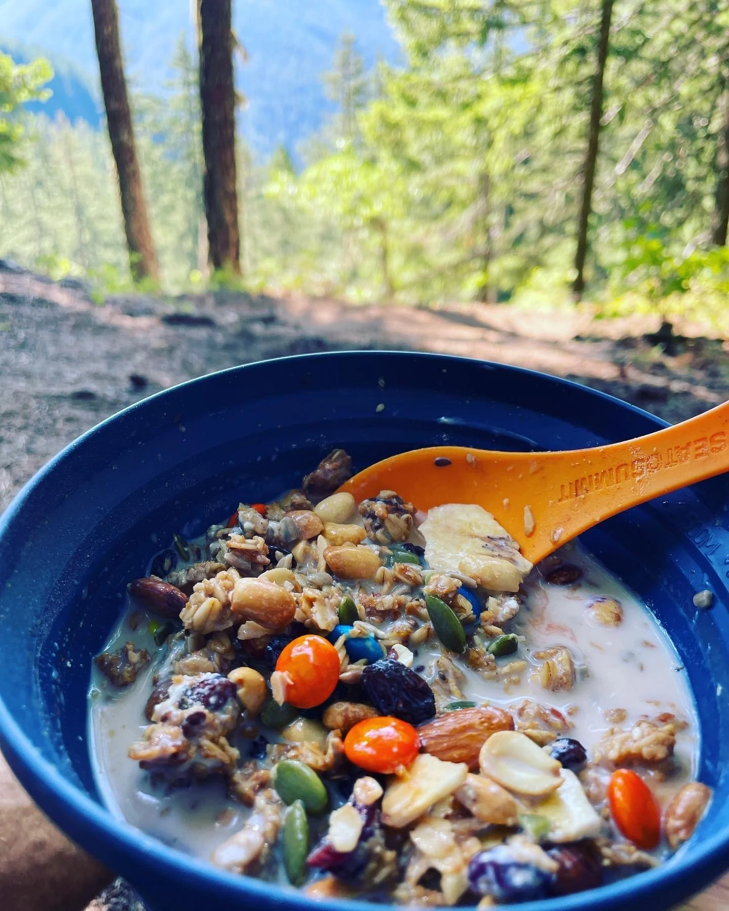
DIY
Here are a few reasonably lightweight, healthy and high calorie ideas:
Porridge or Granola with fortified milk powder/ dried fruit/ nuts and or seeds/ chocolate chips/ Nutella or peanut butter.
Burrito wraps (a staple on the PCT). Chorizo if you’re a meat eater.
Ramen noodles
Butter - doesn’t melt as much as you think and super high in calories. Store in a ziplock bag!
Instant mash - check out Idahoan mashed potatoes
Cheese strings or similar
Seaweed sheets
Dehydrated vegetables (such as mushrooms or tomatoes)
Consider a sauce (i.e tabasco or a flavoured mayonnaise just to add some flavour!)
As a general snack adding nuts and seeds is a great option to maximise calories. Peanuts are one of the best.


Hygiene
Before setting off on our first thru-hike, hygiene is something we thought a lot about since we needed lightweight but effective long-term solutions. Here’s a few tips to get you started
1. Hand Sanitiser
Soap and water can’t be beaten but in leau of that then hand sanitiser is your friend on trail to try and minimise those pesky germs. If you splash out on a nicely scented one then it can make you feel extra fresh, especially if you’ve been out for a while.
2. Kula Cloth
We had never heard of these until a few days before starting the PCT but I’m so glad that I bought a Kula Cloth in REI just before setting off. It is an antimicrobial pee cloth that you use to pat dry. It therefore avoids either having that uncomfortable wet feeling in your underwear or having to use toilet roll, which really isn’t practical in the wild.
Prior to testing it out I was a little concerned about whether it would actually be antimicrobial and hygienic but after 10 months of fairly intensive use I’ve encountered no problems at all and find it quick and easy to clean. Kula is an American company but with a quick google you can find UK retailers selling them and I would recommend them for day hikes as well as multi-day trips.
3. Trowel and Toilet Roll
There comes a time in (almost) every hiker’s life when you need to have a poo in the woods. It’s not the most fun topic but it’s an important one to think about, particularly in terms of the Leave No Trace principles.
Make sure to buy a sturdy little trowel to help you dig a cathole which should be 6-8 inches deep and 4-6 inches in diameter and at least 200 feet away from water, camp and trails. It should go without saying… but make sure to re-fill the cathole once you’re done. General advice is either to bury your toilet paper deep in a cathole or pack it out. Of course packing it out is always going to be by far the most preferable and certainly necessary if you’re using wipes. For more details I’d recommend checking out this website.
As always, it’s a good idea to also do some research into the specific place you’re hiking. For example, there may be public toilet facilities nearby that are preferable to use. Or as we found out at Mount Whitney in the USA it is required to pack out your human waste from this specific area.
Reading to enhance your hike
Whilst just getting some fresh air and enjoying the scenery is more than enough reason to venture out, there is often so much going on around you that isn’t always obvious. Below are a few book ideas, some we’ve read and some are waiting to be read - if they’re no good we’ll remove them from the list :) We’ve found that having a better understanding of the world around you can make a massive difference to you adventures, which is kind of obvious really!
The Treeline by Ben Rawlence
Entangled Life by Merlin Sheldrake
Cornerstones by Benedict Macdonald
The Walkers Guide to Outdoor Clues and Signs by Tristan Gooley
A Sand County Almanac and Sketches Here and There by Aldo Leopold
A Life on Our Planet by David Attenborough
Who Owns England by Guy Shrubsole
Rewilding by Cain Blythe
Regeneration by Andrew Painting
The Last Wilderness by Neil Ansell